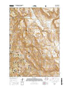
2017 Map of Van
USGS Topo · Published 2017About this map
The settlement of Van anchors this high-desert landscape in Harney County, positioned along the Van-Drewsey Rd where the waters of Wolf Cr and Calamity Cr meet. This 2017 survey reveals an intricate network of springs and drainage systems vital to the region's ranching and natural history, including the Cleveland Ditch and the Duck Cr Reservoir. Much of the terrain is dominated by the Malheur National Forest, where labels indicate a long history of named water sources such as Little Britches Spring, Diamond J Spring, and McElroy Spring. The topography rises toward landmarks like Capps Mtn and opens into grazing areas like Potts Field. This map provides a clear view of the complex water rights and forest access roads, such as Gunbarrel Rd and Calamity Rd, that have sustained this portion of the Oregon backcountry for generations.
Find a feature on this map
39 named features on this map. Tap any name to fly to it.
Don’t see what you’re looking for? This feature index may not catch every label — zoom into the map to look around manually.
Map Details
Editions of this 2017 Van Map
This is the sole edition of this map. No revisions or reprints were ever made.
Other maps of this area

1955 · Burns
USGS Topo · 1:250,000

1955 · Canyon City
USGS Topo · 1:250,000

1958 · Burns
USGS Topo · 1:250,000

1959 · Burns
USGS Topo · 1:250,000

1959 · Canyon City
USGS Topo · 1:250,000

1961 · Calamity Butte
USGS Topo · 1:62,500

1961 · Logan Valley
USGS Topo · 1:62,500

1961 · Seneca
USGS Topo · 1:62,500

1968 · Van
USGS Topo · 1:62,500

1978 · John Day
USGS Topo · 1:100,000