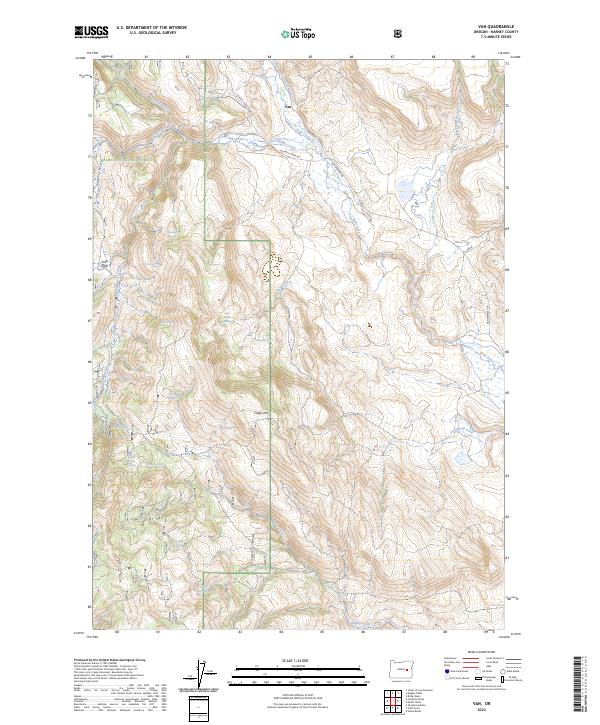
2023 Map of Van
USGS Topo · Published 2023About this map
Van sits at the junction of high-desert drainage systems and forest boundaries in Harney County. This landscape is defined by its water sources, where dozens of named springs such as Basco Spring, Little Briches Spring, and McEwen Spring support life in an otherwise arid environment. The transition from the open flats of Potts Field to the timbered slopes of the Malheur National Forest is marked by significant topographical features like Capps Mtn.
Find a feature on this map
34 named features on this map. Tap any name to fly to it.
Don’t see what you’re looking for? This feature index may not catch every label — zoom into the map to look around manually.
Map Details
Editions of this 2023 Van Map
This is the sole edition of this map. No revisions or reprints were ever made.
Other maps of this area

1955 · Burns
USGS Topo · 1:250,000

1955 · Canyon City
USGS Topo · 1:250,000

1958 · Burns
USGS Topo · 1:250,000

1959 · Burns
USGS Topo · 1:250,000

1959 · Canyon City
USGS Topo · 1:250,000

1961 · Calamity Butte
USGS Topo · 1:62,500

1961 · Logan Valley
USGS Topo · 1:62,500

1961 · Seneca
USGS Topo · 1:62,500

1968 · Van
USGS Topo · 1:62,500

1978 · John Day
USGS Topo · 1:100,000