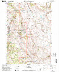
1999 Map of Van
USGS Topo · Published 2002About this map
Malheur National Forest defines the western half of this landscape, where the high-desert terrain of Harney County is punctuated by numerous named water sources essential to both livestock and travelers. The topographic relief is anchored by Calamity Butte and the winding course of Calamity Creek, with a network of springs such as Diamond J Spring and Skookum Spring providing vital points of reference across the drainages.
Find a feature on this map
27 named features on this map. Tap any name to fly to it.
Don’t see what you’re looking for? This feature index may not catch every label — zoom into the map to look around manually.
Map Details
Editions of this 1999 Van Map
This is the sole edition of this map. No revisions or reprints were ever made.
Other maps of this area

1955 · Burns
USGS Topo · 1:250,000

1955 · Canyon City
USGS Topo · 1:250,000

1958 · Burns
USGS Topo · 1:250,000

1959 · Burns
USGS Topo · 1:250,000

1959 · Canyon City
USGS Topo · 1:250,000

1961 · Calamity Butte
USGS Topo · 1:62,500

1961 · Logan Valley
USGS Topo · 1:62,500

1961 · Seneca
USGS Topo · 1:62,500

1968 · Van
USGS Topo · 1:62,500

1978 · John Day
USGS Topo · 1:100,000