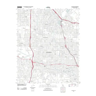
2012 Map of Van Nuys
USGS Topo · Published 2012About this map
Van Nuys Airport dominates the northwestern reaches of this San Fernando Valley landscape, serving as a focal point for the dense residential and industrial grid. The map illustrates a highly developed suburban corridor where established neighborhoods like Panorama City and Sherman Oaks are knit together by major thoroughfares such as Ventura Blvd. To the south, the terrain shifts abruptly as the flat valley floor meets the northern slopes of the Santa Monica Mountains, marked by the winding path of Mulholland Dr and deep-cut features like Fryman Canyon. This 2012 survey captures the area's intricate water management system, including the channelized Los Angeles River and its tributaries like Pacoima Wash and Tujunga Wash. Cultural and media landmarks are prominent, from the sprawling grounds of CBS Studios in Studio City to the American Jewish University overlooking the valley, reflecting the diverse institutional footprint of Los Angeles.
Find a feature on this map
43 named features on this map. Tap any name to fly to it.
Don’t see what you’re looking for? This feature index may not catch every label — zoom into the map to look around manually.
Map Details
Editions of this 2012 Van Nuys Map
This is the sole edition of this map. No revisions or reprints were ever made.
Other maps of this area

1894 · Los Angeles
USGS Topo · 1:62,500

1896 · Santa Monica
USGS Topo · 1:62,500

1898 · Santa Monica
USGS Topo · 1:62,500

1900 · Los Angeles
USGS Topo · 1:62,500

1900 · Fernando
USGS Topo · 1:62,500

1901 · Southern California Sheet No. 1
USGS Topo · 1:250,000

1902 · Santa Monica
USGS Topo · 1:62,500

1903 · Calabasas
USGS Topo · 1:62,500

1903 · Camulos
USGS Topo · 1:125,000

1903 · Santa Susana
USGS Topo · 1:62,500
Featured Places
- Los Angeles, CA
- Los Angeles County, CA
- United States
- California
- Van Nuys Neighborhood Council District, Los Angeles