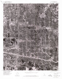
1976 Map of Van Nuys
USGS Topo · Published 1980About this map
Van Nuys and the surrounding San Fernando Valley districts appear here in a transition toward dense mid-century suburbanization, captured through an orthophotographic lens in the late 1970s. The landscape is defined by a rigid grid of residential streets and commercial corridors that contrast sharply with the naturalistic flow of the Los Angeles River winding through the southern portion of the sheet. This aerial perspective highlights the sheer scale of development within the Los Angeles city limits, showcasing the massive expansion of housing and infrastructure that occurred before the final decades of the millennium. By focusing on the built environment rather than topographic contours, the map reveals the intricate patterns of neighborhood blocks and the significant footprint of the North Hollywood area during this period of high-growth urban maturity.
Find a feature on this map
4 named features on this map. Tap any name to fly to it.
Don’t see what you’re looking for? This feature index may not catch every label — zoom into the map to look around manually.
Map Details
Editions of this 1976 Van Nuys Map
This is the sole edition of this map. No revisions or reprints were ever made.
Other maps of this area

1894 · Los Angeles
USGS Topo · 1:62,500

1896 · Santa Monica
USGS Topo · 1:62,500

1898 · Santa Monica
USGS Topo · 1:62,500

1900 · Los Angeles
USGS Topo · 1:62,500

1900 · Fernando
USGS Topo · 1:62,500

1901 · Southern California Sheet No. 1
USGS Topo · 1:250,000

1902 · Santa Monica
USGS Topo · 1:62,500

1903 · Calabasas
USGS Topo · 1:62,500

1903 · Camulos
USGS Topo · 1:125,000

1903 · Santa Susana
USGS Topo · 1:62,500
Featured Places
- Los Angeles, CA
- Los Angeles County, CA
- United States
- California
- Van Nuys Neighborhood Council District, Los Angeles