
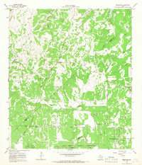
1953 Map of Van Raub
USGS Topo · Published 1959About this map
Van Raub and the surrounding Hill Country terrain are captured here in the early 1950s, a period before the rapid suburbanization of northern Bexar County. The landscape is defined by its watercourses, including Balcones Creek and Leon Creek, which carve through the limestone hills and valleys. Small community hubs like the Lower Balcones Sch and a local Cem reflect the rural social structure of the era, while the Southern Pacific railroad provides a primary industrial artery through the eastern half of the map. To the southeast, Leon Springs serves as a notable waypoint near the military grounds of Camp Stanley. The presence of the Concept Therapy Institute and a dedicated Ball Park near the rail line suggests a mix of traditional ranching life and emerging recreational or specialized land uses during this postwar window.
Find a feature on this map
21 named features on this map. Tap any name to fly to it.
Don’t see what you’re looking for? This feature index may not catch every label — zoom into the map to look around manually.
Map Details
Editions of this 1953 Van Raub Map
This is the sole edition of this map. No revisions or reprints were ever made.
Other maps of this area

1953 · Otis Ridge
USGS Topo · 1:24,000

1953 · Helotes
USGS Topo · 1:24,000

1953 · Castle Hills
USGS Topo · 1:24,000

1954 · San Antonio
USGS Topo · 1:250,000

1956 · Comfort
USGS Topo · 1:62,500

1956 · Medina Lake
USGS Topo · 1:62,500

1957 · Boerne
USGS Topo · 1:62,500

1957 · San Antonio
USGS Topo · 1:250,000

1964 · Boerne
USGS Topo · 1:24,000
1964 · Bergheim
USGS Topo · 1:24,000