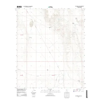
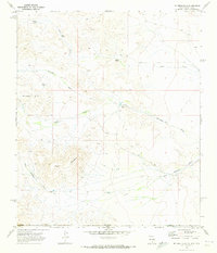
2013 Map of Van Winkle Lake
USGS Topo · Published 2013About this map
Van Winkle Lake and the surrounding drainage basins of Otero County define this desert landscape in the early 21st century. The map reveals an intricate network of county roads, including CO Road F041 and CO Road G001, which navigate a terrain carved by numerous seasonal watercourses. These geographical features, such as Jack Smith Draw, Coffelt Draw, and Shiloh Draw, illustrate the complex natural irrigation and erosion patterns of this arid region. Significant local landmarks like Brownfield Hill provide vertical relief against the canyon systems of Lewis Canyon and Boardwell Canyon. This U.S. Geological Survey topographic study captures the infrastructure of the area, notably the Jack Smith Tank, which serves as a critical water management point in the T24S and T25S township ranges.
Find a feature on this map
19 named features on this map. Tap any name to fly to it.
Don’t see what you’re looking for? This feature index may not catch every label — zoom into the map to look around manually.
Map Details
Editions of this 2013 Van Winkle Lake Map
This is the sole edition of this map. No revisions or reprints were ever made.
Other maps of this area

1954 · Carlsbad
USGS Topo · 1:250,000

1958 · Carlsbad
USGS Topo · 1:250,000

1963 · Hackberry Hill
USGS Topo · 1:24,000
1963 · Cornucopia Ranch SE
USGS Topo · 1:24,000

1963 · Cleones Tank
USGS Topo · 1:24,000

1969 · Lewis Canyon
USGS Topo · 1:24,000
1969 · Culp Draw
USGS Topo · 1:24,000
1970 · Shiloh Hills SE
USGS Topo · 1:24,000
1970 · Mc Veigh Hills
USGS Topo · 1:24,000

1970 · Shiloh Hills
USGS Topo · 1:24,000