
1968 Map of Van Wyck
USGS Topo · Published 1970About this map
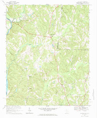
The Catawba River defines the western edge of this Lancaster County landscape, where the Seaboard Coast Line and Southern railroads intersect the rural terrain. This 1968 field-checked survey reveals a territory deeply rooted in its local institutions, evidenced by the numerous country churches like White Oak Ch, Jackson Grove Ch, and Mt Zion Ch that anchor small crossroads communities. Andrew Jackson State Park stands near the center of the sheet, commemorating the region's heritage near the South Carolina-North Carolina border.
Find a feature on this map
45 named features on this map. Tap any name to fly to it.
Don’t see what you’re looking for? This feature index may not catch every label — zoom into the map to look around manually.
Map Details
Editions of this 1968 Van Wyck Map
2 editions found
Other maps of this area

1941 · Spartanburg
USGS Topo · 1:250,000

1953 · Spartanburg
USGS Topo · 1:250,000

1960 · Spartanburg
USGS Topo · 1:250,000

1963 · Spartanburg
USGS Topo · 1:250,000

1964 · Spartanburg
USGS Topo · 1:250,000

1968 · Catawba
USGS Topo · 1:24,000
1968 · Catawba NE
USGS Topo · 1:24,000
1968 · Rock Hill East
USGS Topo · 1:24,000

1969 · Antioch
USGS Topo · 1:24,000
1969 · Lancaster
USGS Topo · 1:24,000