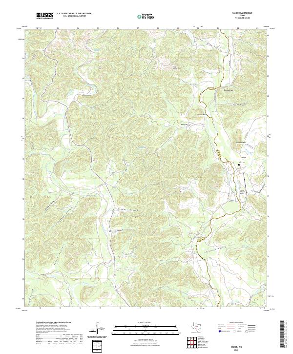
2022 Map of Vance
USGS Topo · Published 2022About this map
The Nueces River winds through this section of the Texas Hill Country, marking a distinct natural boundary that follows the line between Edwards and Real Counties. The small settlement of Vance serves as the primary focal point, situated near the Vance Cemetery and the Flying Bull Ranch Airport. The landscape is defined by an intricate network of drainage patterns, with numerous named canyons and hollows such as Racetrack Hollow, Reagan Hollow, and Blackhawk Hollow cutting into the high ground. Prominent peaks like Seep Spring Mountain, Bullhead Mountain, and Perkins Mountain overlook the river valley, while localized water sources such as Round Hole Spring and Greenhouse Spring appear in the upland draws. This map illustrates the modern rural infrastructure, where Ranch Road 335 provides the main corridor through the rugged Edwards Plateau terrain.
Find a feature on this map
47 named features on this map. Tap any name to fly to it.
Don’t see what you’re looking for? This feature index may not catch every label — zoom into the map to look around manually.
Map Details
Editions of this 2022 Vance Map
This is the sole edition of this map. No revisions or reprints were ever made.
Other maps of this area

1893 · Nueces
USGS Topo · 1:125,000

1896 · Nueces
USGS Topo · 1:125,000

1944 · Barksdale
USGS Topo · 1:62,500

1947 · Hackberry
USGS Topo · 1:62,500

1954 · San Antonio
USGS Topo · 1:250,000

1957 · San Antonio
USGS Topo · 1:250,000

1957 · York Hollow
USGS Topo · 1:62,500

1958 · Del Rio
USGS Topo · 1:250,000

1964 · Del Rio
USGS Topo · 1:250,000
1971 · Cub Lake
USGS Topo · 1:24,000