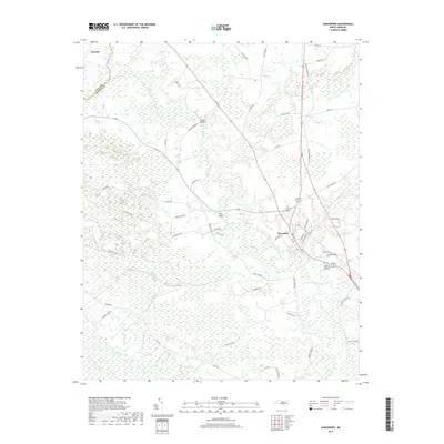
2019 Map of Vanceboro
USGS Topo · Published 2019About this map
Vanceboro and its surrounding wetlands define the landscape where the Neuse River and Swift Creek converge. This survey shows the region's complex drainage network, characterized by extensive tracts of bottomland such as Baybush Swamp, Palmetto Swamp, and Mauls Swamp. These natural features have historically dictated the placement of roads and river crossings, evidenced by landmarks like Biddle Bridge and Folly Bridge. To the northwest, the settlement of Clayroot sits near the Pitt Co and Craven Co line. The town of Vanceboro itself is mapped in detail, showing a grid of local streets including Main St and Farm Life Ave near the local memorial grounds at Celestial Memorial Gardens. The map also illustrates the transition from riverine woods to agricultural holdings along routes like Streets Ferry Rd and River Rd.
Find a feature on this map
56 named features on this map. Tap any name to fly to it.
Don’t see what you’re looking for? This feature index may not catch every label — zoom into the map to look around manually.
Map Details
Editions of this 2019 Vanceboro Map
This is the sole edition of this map. No revisions or reprints were ever made.
Other maps of this area

1901 · New Bern
USGS Topo · 1:62,500

1902 · Ayden
USGS Topo · 1:62,500

1902 · Vanceboro
USGS Topo · 1:62,500

1903 · New Bern
USGS Topo · 1:62,500

1903 · Trent River
USGS Topo · 1:62,500

1904 · Ayden
USGS Topo · 1:62,500

1904 · Trent River
USGS Topo · 1:62,500

1904 · Vanceboro
USGS Topo · 1:62,500

1905 · Vanceboro
USGS Topo · 1:62,500

1951 · Hackney
USGS Topo · 1:24,000