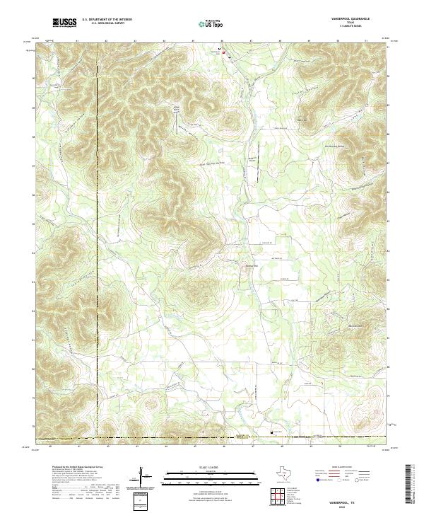
2022 Map of Vanderpool
USGS Topo · Published 2022About this map
The Sabinal River and its western branch, the W Sabinal River, carve a complex drainage system through these limestone highlands where the borders of Real, Bandera, and Uvalde counties converge. The landscape is defined by its deep canyons and named draws, including Starvation Hollow, Marshy Hollow, and Blackjack Hollow. Local transport follows the natural contours of the river valleys, with FM 337e and Ranch Rd 187 serving as primary corridors for the ranching community.
Find a feature on this map
59 named features on this map. Tap any name to fly to it.
Don’t see what you’re looking for? This feature index may not catch every label — zoom into the map to look around manually.
Map Details
Editions of this 2022 Vanderpool Map
This is the sole edition of this map. No revisions or reprints were ever made.
Other maps of this area

1954 · San Antonio
USGS Topo · 1:250,000

1956 · Tarpley
USGS Topo · 1:62,500

1956 · Tuff
USGS Topo · 1:62,500

1956 · Utopia
USGS Topo · 1:62,500

1957 · San Antonio
USGS Topo · 1:250,000

1960 · Magers Crossing
USGS Topo · 1:24,000

1964 · Circle Bluff
USGS Topo · 1:24,000

1964 · Sabinal Canyon
USGS Topo · 1:24,000
1964 · Love Creek
USGS Topo · 1:24,000
1964 · Seco Pass
USGS Topo · 1:24,000