
1964 Map of Sabinal Canyon
USGS Topo · Published 1967About this map
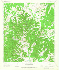
Sabinal Canyon dominates this portion of the Texas Hill Country along the border of Real and Bandera Counties. The landscape is defined by the headwaters of the Sabinal River and its western branch, the West Sabinal River, as well as the North Prong Medina River to the east. This 1964 survey captures a rural landscape characterized by family-named hollows and water features that reflect the region's ranching history, such as Wedgeworth and Post Oak Waterhole. A distinct Landing Strip and multiple pipelines indicate the infrastructure of the mid-20th century. Local landmarks like Flatrock Spring and Pelaez Lake are documented alongside numerous tributaries, including Marler Creek and Jernigan Hollow, providing a detailed record of the drainage patterns and historical property boundaries in this deeply carved canyon terrain.
Find a feature on this map
33 named features on this map. Tap any name to fly to it.
Don’t see what you’re looking for? This feature index may not catch every label — zoom into the map to look around manually.
Map Details
Editions of this 1964 Sabinal Canyon Map
2 editions found
Other maps of this area

1954 · San Antonio
USGS Topo · 1:250,000

1956 · Tarpley
USGS Topo · 1:62,500

1956 · Tuff
USGS Topo · 1:62,500

1956 · Utopia
USGS Topo · 1:62,500

1957 · San Antonio
USGS Topo · 1:250,000

1964 · Hillcrest Ranch
USGS Topo · 1:24,000

1964 · Circle Bluff
USGS Topo · 1:24,000

1964 · Well Hollow
USGS Topo · 1:24,000

1964 · Diamond S Ranch
USGS Topo · 1:24,000
1964 · Love Creek
USGS Topo · 1:24,000