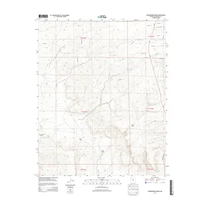
2013 Map of Vanderwagen Draw
USGS Topo · Published 2013About this map
Vanderwagen Draw and the adjacent White Canyon define this section of the New Mexico landscape, where the high desert terrain is carved by seasonal drainage systems. The map illustrates a complex network of ephemeral waterways including Bosson Wash and Oak Wash, which direct the flow of water through the arid plateau. Human presence is marked primarily by a grid of rural routes and service roads that navigate the varying elevations. Notable transportation corridors such as NM-602 and Indian Service Route 4 provide access to the interior, while local thoroughfares like Bosson Wash Rd and Stonehenge Rd connect the scattered land parcels. The prominence of Dubois Hill serves as a primary vertical landmark in a region otherwise characterized by deep draws like Y Unit Draw.
Find a feature on this map
26 named features on this map. Tap any name to fly to it.
Don’t see what you’re looking for? This feature index may not catch every label — zoom into the map to look around manually.
Map Details
Editions of this 2013 Vanderwagen Draw Map
This is the sole edition of this map. No revisions or reprints were ever made.
Other maps of this area

1886 · Wingate
USGS Topo · 1:250,000

1892 · Wingate
USGS Topo · 1:250,000

1954 · Gallup
USGS Topo · 1:250,000

1958 · Gallup
USGS Topo · 1:250,000

1959 · Gallup
USGS Topo · 1:250,000

1962 · Gallup
USGS Topo · 1:250,000

1963 · Jones Ranch School
USGS Topo · 1:24,000

1963 · Pinehaven
USGS Topo · 1:24,000
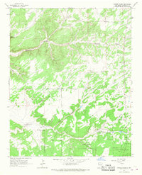
1963 · Vander Wagen
USGS Topo · 1:24,000

1967 · Gallup
USGS Topo · 1:250,000