
1963 Map of Pinehaven
USGS Topo · Published 1967About this map
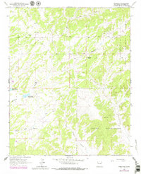
Pinehaven (Ruins) and the small settlement of Nelson anchor this mid-century look at McKinley County, where the landscape is defined by the intersection of the Cibola National Forest and the Zuni Indian Reservation. The mapping captures a network of essential water sources in an arid environment, notably the Vander Wagen Reservoir No 1, Vander Wagen Reservoir No 2, and Pintos Lake. This 1963 field-checked data provides an important record for genealogists and local historians, locating the Navajo Ch and Pinehaven Cem near the central drainage of Whitewater Arroyo. The presence of Coal Mine Canyon and Pine Tree Wash suggests the rugged drainage patterns that dictated early road placement and land use before subsequent development altered the local geography.
Find a feature on this map
13 named features on this map. Tap any name to fly to it.
Don’t see what you’re looking for? This feature index may not catch every label — zoom into the map to look around manually.
Map Details
Editions of this 1963 Pinehaven Map
2 editions found
Other maps of this area

1886 · Wingate
USGS Topo · 1:250,000

1892 · Wingate
USGS Topo · 1:250,000

1954 · Gallup
USGS Topo · 1:250,000

1958 · Gallup
USGS Topo · 1:250,000

1959 · Gallup
USGS Topo · 1:250,000

1962 · Gallup
USGS Topo · 1:250,000

1963 · Twin Buttes
USGS Topo · 1:24,000
1963 · Upper Nutria
USGS Topo · 1:24,000
1963 · Bread Springs
USGS Topo · 1:24,000
1963 · Fort Wingate
USGS Topo · 1:24,000