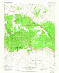
1963 Map of Fort Wingate
USGS Topo · Published 1967About this map
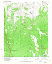
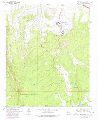
Fort Wingate and the Fort Wingate Army Depot dominate this mid-century New Mexico landscape, illustrating the intersection of military operations and education. The depot occupies the western expanse, while the community of Fort Wingate is centered near the Wingate High Sch and several recreational facilities like the Picnic Area and Athletic Field. A Historical Monument stands as a reminder of the site's long-standing strategic importance.
Find a feature on this map
36 named features on this map. Tap any name to fly to it.
Don’t see what you’re looking for? This feature index may not catch every label — zoom into the map to look around manually.
Map Details
Editions of this 1963 Fort Wingate Map
2 editions found
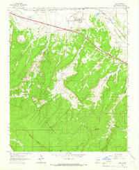
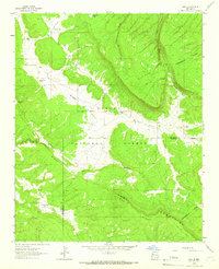
Other maps of this area

1886 · Wingate
USGS Topo · 1:250,000

1892 · Wingate
USGS Topo · 1:250,000

1954 · Gallup
USGS Topo · 1:250,000

1958 · Gallup
USGS Topo · 1:250,000

1959 · Gallup
USGS Topo · 1:250,000

1962 · Gallup
USGS Topo · 1:250,000
1962 · Ciniza
USGS Topo · 1:24,000
1962 · Page
USGS Topo · 1:24,000
1963 · Pinedale
USGS Topo · 1:24,000
1963 · Church Rock
USGS Topo · 1:24,000