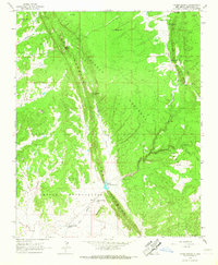
1963 Map of Upper Nutria
USGS Topo · Published 1967About this map
The Zuni Indian Reservation landscape is dominated by the dramatic uplift of The Hogback, a striking geological spine that runs through the heart of this 1963 survey. Settlements such as Upper Nutria and Lower Nutria are situated along the Rio Nutria, which serves as the primary drainage for the area, collected in the Nutria Diversion Reservoir. To the northeast, the terrain transitions into the Cibola National Forest, where the community of McGaffey and its associated McGaffey Recreation Area are located.
Find a feature on this map
30 named features on this map. Tap any name to fly to it.
Don’t see what you’re looking for? This feature index may not catch every label — zoom into the map to look around manually.
Map Details
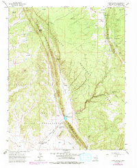
Editions of this 1963 Upper Nutria Map
2 editions found
Other maps of this area

1886 · Wingate
USGS Topo · 1:250,000

1892 · Wingate
USGS Topo · 1:250,000

1954 · Gallup
USGS Topo · 1:250,000

1958 · Gallup
USGS Topo · 1:250,000

1959 · Gallup
USGS Topo · 1:250,000

1962 · Gallup
USGS Topo · 1:250,000

1962 · Ciniza
USGS Topo · 1:24,000

1962 · Page
USGS Topo · 1:24,000
1963 · Ramah
USGS Topo · 1:24,000

1963 · Pinehaven
USGS Topo · 1:24,000