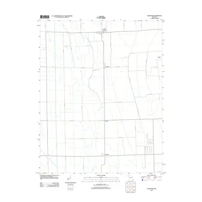
2012 Map of Vanduser
USGS Topo · Published 2012About this map
Vanduser anchors the northern portion of this agricultural landscape in Scott County, Missouri, where the gridded road network meets the meandering course of the Little River. This 2012 survey captures the rural character of the Missouri Bootheel region, showing a series of small, dispersed settlements including Crowder, Tanner, and Salcedo along the north-south transit corridors. The terrain is notably flat, typical of the Mississippi Alluvial Plain, with the Little River providing the primary natural drainage through a landscape heavily modified for cultivation. Genealogists and local researchers will find the Carpenter Cemetery situated in the northeast, one of the few designated landmarks within the expansive field systems defined by roads such as Co Hwy 445 and Co Hwy 452.
Find a feature on this map
37 named features on this map. Tap any name to fly to it.
Don’t see what you’re looking for? This feature index may not catch every label — zoom into the map to look around manually.
Map Details
Editions of this 2012 Vanduser Map
This is the sole edition of this map. No revisions or reprints were ever made.
Other maps of this area

1931 · Sikeston
USGS Topo · 1:62,500

1934 · Morley
USGS Topo · 1:62,500

1934 · Bloomfield
USGS Topo · 1:62,500

1934 · Sikeston
USGS Topo · 1:62,500

1934 · Advance
USGS Topo · 1:62,500

1939 · Bloomfield
USGS Topo · 1:62,500

1939 · Sikeston
USGS Topo · 1:62,500

1939 · Morley
USGS Topo · 1:62,500

1939 · Advance
USGS Topo · 1:62,500

1949 · Paducah
USGS Topo · 1:250,000