2021 Map of Vanduser
USGS Topo · Published 2021About this map
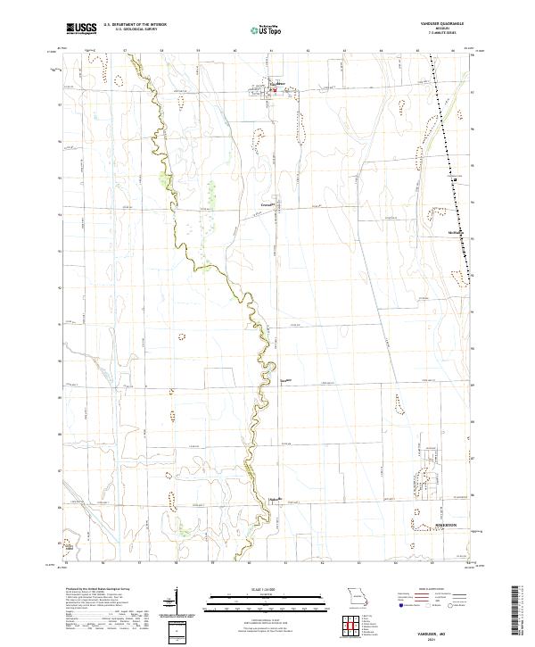
Vanduser sits at the northern edge of this agricultural landscape in the Missouri Bootheel, where the channelized Little River meanders southward toward Salcedo. The terrain is defined by its drainage history, with the Mud Slough winding through the western fields and the Scott Co and Stoddard Co boundary line cutting through the northwest corner. This 2021 survey reveals a structured grid of rural roads and small crossroads settlements such as Crowder, McMullin, and Tanner. Genealogy researchers may find interest in the isolated Carpenter Cem located east of Crowder, while the outskirts of Sikeston begin to appear in the southeastern quadrant. The map illustrates how local transportation remains tied to the historical section lines, with routes like State Hwy Z and State Hwy ZZ connecting these small farming communities.
Find a feature on this map
63 named features on this map. Tap any name to fly to it.
Don’t see what you’re looking for? This feature index may not catch every label — zoom into the map to look around manually.
Map Details
Editions of this 2021 Vanduser Map
This is the sole edition of this map. No revisions or reprints were ever made.