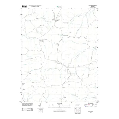
2010 Map of Vanleer
USGS Topo · Published 2010About this map
Vanleer serves as the central hub of this northern Tennessee landscape, where the iron industry's legacy persists through place names like Furnace Creek and Bell Mine. The topography is defined by a dense network of hollows, including Logans Hollow and Browns Hollow, which guide the path of numerous waterways such as Bear Creek and Bartons Creek. For genealogists, the map is particularly detailed, recording nearly twenty burial sites including Nichols Cemetery, Seals Cemetery, and Fraudenthal Cemetery. The southern portion of the quadrangle shows a shift toward modern infrastructure with the Dickson Municipal Airport situated near the headwaters of Yellow Creek. These features illustrate a transition from a remote agricultural and mining district to one integrated into the regional transportation network, while still maintaining the family-named landmarks of its early settlement.
Find a feature on this map
85 named features on this map. Tap any name to fly to it.
Don’t see what you’re looking for? This feature index may not catch every label — zoom into the map to look around manually.
Map Details
Editions of this 2010 Vanleer Map
This is the sole edition of this map. No revisions or reprints were ever made.
Other maps of this area

1931 · Erin
USGS Topo · 1:62,500

1936 · Ruskin
USGS Topo · 1:24,000

1936 · Burns
USGS Topo · 1:24,000

1936 · Tennessee City
USGS Topo · 1:24,000

1936 · Dickson
USGS Topo · 1:24,000

1953 · Dickson
USGS Topo · 1:24,000
1953 · Tennessee City
USGS Topo · 1:24,000

1953 · Burns
USGS Topo · 1:24,000
1953 · Ruskin
USGS Topo · 1:24,000

1956 · Nashville
USGS Topo · 1:250,000