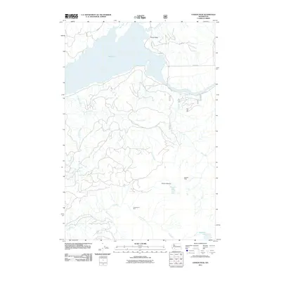
2011 Map of Vanson Peak
USGS Topo · Published 2011About this map
Independence Mine sits south of Vanson Peak, anchoring a landscape defined by the drainage systems of the Cowlitz River and the Green River. This 2011 topographic record shows a rugged network of forest access routes like Logging Rd and Nat For Dev Rd 2742 weaving through the timberlands. To the north, the waters of Riffe Lake meet the mouth of Rainey Creek in Rainey Valley, highlighting the intersection of industrial land use and major hydroelectric reservoirs. High-altitude features such as Vanson Meadow and the secluded Vanson Lake provide clear landmarks for those studying the backcountry terrain. The map's detail of numerous creeks, including Wakedwasis Creek and Landers Creek, illustrates the complex hydrology of the Cascades foothills.
Find a feature on this map
23 named features on this map. Tap any name to fly to it.
Don’t see what you’re looking for? This feature index may not catch every label — zoom into the map to look around manually.
Map Details
Editions of this 2011 Vanson Peak Map
This is the sole edition of this map. No revisions or reprints were ever made.
Other maps of this area

1919 · Mount St Helens
USGS Topo · 1:125,000

1937 · Eatonville
USGS Topo · 1:125,000

1953 · Hoquiam
USGS Topo · 1:250,000

1953 · Elk Rock
USGS Topo · 1:62,500

1956 · Mineral
USGS Topo · 1:62,500

1957 · Hoquiam
USGS Topo · 1:250,000

1957 · Morton
USGS Topo · 1:62,500

1957 · Spirit Lake
USGS Topo · 1:62,500

1958 · Hoquiam
USGS Topo · 1:250,000

1962 · Hoquiam
USGS Topo · 1:250,000