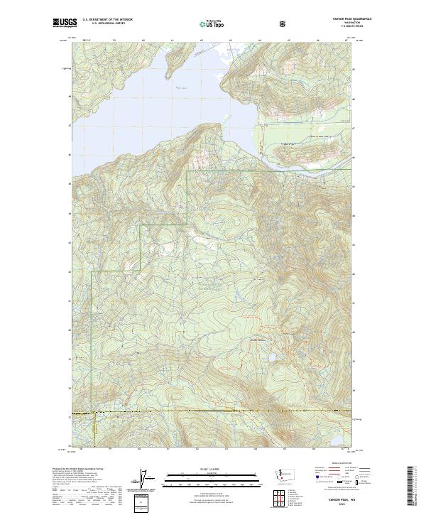
2023 Map of Vanson Peak
USGS Topo · Published 2023About this map
Vanson Peak and the surrounding high country of the Gifford Pinchot National Forest dominate this landscape near the tri-county boundary of Lewis, Skamania, and Cowlitz. The northern portion of the map is defined by the expansive waters of Riffe Lake and the Cowlitz River, where infrastructure like Glenoma Rd and various logging routes provide access to the timberlands. The southern sections transition into the protected landscape of the Mount Saint Helens National Volcanic Monument, centered around the Green River drainage.
Find a feature on this map
30 named features on this map. Tap any name to fly to it.
Don’t see what you’re looking for? This feature index may not catch every label — zoom into the map to look around manually.
Map Details
Editions of this 2023 Vanson Peak Map
This is the sole edition of this map. No revisions or reprints were ever made.
Other maps of this area

1919 · Mount St Helens
USGS Topo · 1:125,000

1937 · Eatonville
USGS Topo · 1:125,000

1953 · Hoquiam
USGS Topo · 1:250,000

1953 · Elk Rock
USGS Topo · 1:62,500

1956 · Mineral
USGS Topo · 1:62,500

1957 · Hoquiam
USGS Topo · 1:250,000

1957 · Morton
USGS Topo · 1:62,500

1957 · Spirit Lake
USGS Topo · 1:62,500

1958 · Hoquiam
USGS Topo · 1:250,000

1962 · Hoquiam
USGS Topo · 1:250,000