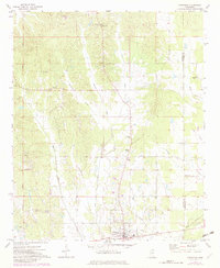
1972 Map of Vardaman
USGS Topo · Published 1982About this map
The town of Vardaman serves as the focal point of this rural Mississippi survey, situated along the southern edge of the quadrangle. The surrounding landscape is defined by a dense network of waterways, including the winding courses of Cane Creek, Walnut Creek, and Hurricane Creek. These streams are flanked by numerous small-scale mining operations, specifically identified as Sandpit and Sandpits, which punctuate the terrain and suggest a local economy tied to the extraction of regional geological materials.
Find a feature on this map
26 named features on this map. Tap any name to fly to it.
Don’t see what you’re looking for? This feature index may not catch every label — zoom into the map to look around manually.
Map Details
Editions of this 1972 Vardaman Map
2 editions found
Other maps of this area

1953 · West Point
USGS Topo · 1:250,000

1954 · Pittsboro
USGS Topo · 1:62,500

1956 · Tupelo
USGS Topo · 1:250,000

1958 · Tupelo
USGS Topo · 1:250,000

1958 · West Point
USGS Topo · 1:250,000

1963 · West Point
USGS Topo · 1:250,000

1972 · Houlka
USGS Topo · 1:24,000

1972 · Robbs
USGS Topo · 1:24,000

1972 · Atlanta
USGS Topo · 1:24,000

1972 · Vardaman
USGS Topo · 1:24,000