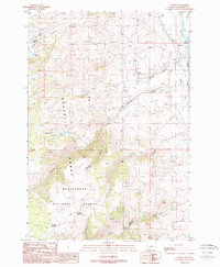
1988 Map of Varney
USGS Topo · Published 1989About this map
Varney and the surrounding high-country landscape of the Gravelly Range are documented in this late 1980s survey. The Madison River dominates the eastern edge of the sheet, providing a vital waterway for the region, while the Ennis National Fish Hatchery stands as a significant landmark near Blaine Spring Creek. The map details a transition from the river valley to the elevated terrain of the Beaverhead National Forest, where high-altitude water bodies like Axolotl Lake, Twin Lakes, and the Haypress Lakes are located.
Find a feature on this map
24 named features on this map. Tap any name to fly to it.
Don’t see what you’re looking for? This feature index may not catch every label — zoom into the map to look around manually.
Map Details
Editions of this 1988 Varney Map
This is the sole edition of this map. No revisions or reprints were ever made.
Other maps of this area

1888 · Three Forks
USGS Topo · 1:250,000

1894 · Three Forks
USGS Topo · 1:250,000

1895 · Three Forks
USGS Topo · 1:250,000

1947 · Bozeman
USGS Topo · 1:250,000

1948 · Bozeman
USGS Topo · 1:250,000

1949 · Varney
USGS Topo · 1:62,500

1949 · Ennis
USGS Topo · 1:62,500

1950 · Cameron
USGS Topo · 1:62,500

1950 · Virginia City
USGS Topo · 1:62,500

1955 · Bozeman
USGS Topo · 1:250,000