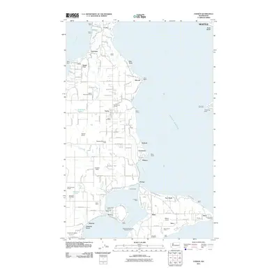
2011 Map of Vashon
USGS Topo · Published 2011About this map
Vashon Island and Maury Island define this nautical landscape, connected by a narrow isthmus at Portage and framing the sheltered waters of Quartermaster Harbor. The settlement pattern follows the intricate coastline and interior ridges, with established communities at Vashon, Burton, and Cedarhurst. Maritime activity is central to the area's identity, evidenced by the Quartermaster Harbor Seaplane Ramp, the Quartermaster Marina, and essential navigation marks like the Robinson Point Lighthouse and Three Tree Point Light.
Find a feature on this map
100 named features on this map. Tap any name to fly to it.
Don’t see what you’re looking for? This feature index may not catch every label — zoom into the map to look around manually.
Map Details
Editions of this 2011 Vashon Map
This is the sole edition of this map. No revisions or reprints were ever made.
Other maps of this area

1894 · Seattle
USGS Topo · 1:62,500

1895 · Snohomish
USGS Topo · 1:125,000

1897 · Tacoma
USGS Topo · 1:125,000

1897 · Seattle
USGS Topo · 1:125,000

1900 · Tacoma
USGS Topo · 1:125,000

1908 · Seattle
USGS Topo · 1:62,500

1909 · Seattle Special
USGS Topo · 1:62,500

1937 · Port Orchard
USGS Topo · 1:62,500

1942 · Gig Harbor
USGS Topo · 1:62,500

1943 · Gig Harbor
USGS Topo · 1:62,500