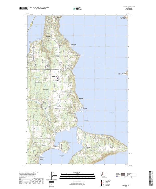
2023 Map of Vashon
USGS Topo · Published 2023About this map
Vashon Island and Maury Island define this coastal landscape, separated from the mainland by Colvos Passage and the East Passage. This modern survey reveals a community organized around the central settlement of Vashon, with residential clusters such as Cedarhurst, Ellisport, and Burton dotting the shorelines. The topography is shaped by the deep indentations of Quartermaster Harbor and Tramp Harbor, which create a distinctive narrow neck of land at Portage.
Find a feature on this map
90 named features on this map. Tap any name to fly to it.
Don’t see what you’re looking for? This feature index may not catch every label — zoom into the map to look around manually.
Map Details
Editions of this 2023 Vashon Map
This is the sole edition of this map. No revisions or reprints were ever made.
Other maps of this area

1894 · Seattle
USGS Topo · 1:62,500

1895 · Snohomish
USGS Topo · 1:125,000

1897 · Tacoma
USGS Topo · 1:125,000

1897 · Seattle
USGS Topo · 1:125,000

1900 · Tacoma
USGS Topo · 1:125,000

1908 · Seattle
USGS Topo · 1:62,500

1909 · Seattle Special
USGS Topo · 1:62,500

1937 · Port Orchard
USGS Topo · 1:62,500

1942 · Gig Harbor
USGS Topo · 1:62,500

1943 · Gig Harbor
USGS Topo · 1:62,500