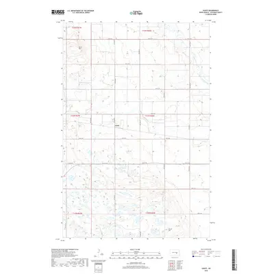
2018 Map of Vashti
USGS Topo · Published 2018About this map
Vashti sits at the center of this rural Stutsman County landscape, which is defined by a dense network of glacial prairie potholes and wetlands. The terrain is notably uneven in the northern section, where the Brush Hills provide a more varied topography compared to the flatter expanses to the south. Pipestem Creek winds through the northeastern corner, accompanied by its namesake tributary Pipestem Cr, creating a rare corridor of drainage in an otherwise internally drained basin. This 2018 survey reveals the persistent grid of section-line roads, such as 67th Ave SE and 15th St SE, which have dictated the agricultural layout of the region for generations. Isolated elevations like Round Top break the horizon, serving as local landmarks in a territory dominated by seasonal water bodies and large-scale farming.
Find a feature on this map
25 named features on this map. Tap any name to fly to it.
Don’t see what you’re looking for? This feature index may not catch every label — zoom into the map to look around manually.
Map Details
Editions of this 2018 Vashti Map
This is the sole edition of this map. No revisions or reprints were ever made.
Other maps of this area

1900 · Pingree
USGS Topo · 1:125,000

1900 · Pingree
USGS Topo · 1:62,500

1948 · Carrington
USGS Topo · 1:62,500

1950 · Melville
USGS Topo · 1:24,000

1950 · Carrington SW
USGS Topo · 1:24,000

1951 · Pingree
USGS Topo · 1:24,000

1951 · Bordulac SW
USGS Topo · 1:24,000

1952 · Pingree SW
USGS Topo · 1:24,000

1952 · New Rockford
USGS Topo · 1:250,000

1956 · New Rockford
USGS Topo · 1:250,000