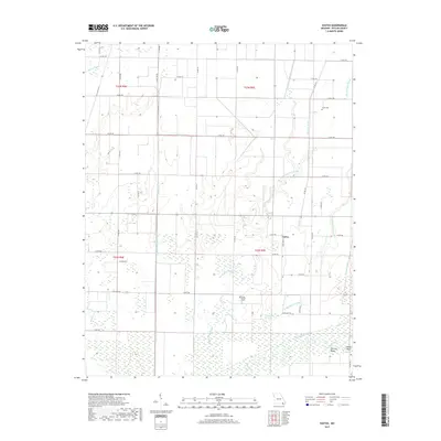
2017 Map of Vastus
USGS Topo · Published 2017About this map
Vastus sits at the center of a heavily managed lowland landscape in southern Butler County, where a complex network of man-made drainage channels has fundamentally altered the natural hydrology of the Missouri Bootheel. The transition from native wetlands to agricultural land is evidenced by the numerous straight-cut watercourses like Harviell Ditch, Cane Creek Ditch, and Ackerman Ditch which crisscross the territory. Despite this engineering, remnants of the original swampy terrain persist in features like Allred Lake and the winding paths of Little Hunting Slough and Big Hunting Slough. To the southeast, the Black River forms distinctive meanders known as Factory Bend and Chester Bend, marking the edge of the survey. Family history and local heritage are anchored by small, rural burial sites including Hyam Cem and Coon Island Cem, providing essential points of reference for genealogists studying the families that settled this alluvial plain.
Find a feature on this map
53 named features on this map. Tap any name to fly to it.
Don’t see what you’re looking for? This feature index may not catch every label — zoom into the map to look around manually.
Map Details
Editions of this 2017 Vastus Map
This is the sole edition of this map. No revisions or reprints were ever made.
Other maps of this area

1935 · Acorn
USGS Topo · 1:62,500

1935 · Rector
USGS Topo · 1:62,500

1935 · Knobel
USGS Topo · 1:62,500

1935 · Harviell
USGS Topo · 1:62,500

1940 · Naylor
USGS Topo · 1:62,500

1941 · Knobel
USGS Topo · 1:62,500

1944 · Naylor
USGS Topo · 1:62,500

1957 · Poplar Bluff
USGS Topo · 1:250,000

1958 · Rector
USGS Topo · 1:62,500

1959 · Poplar Bluff
USGS Topo · 1:250,000