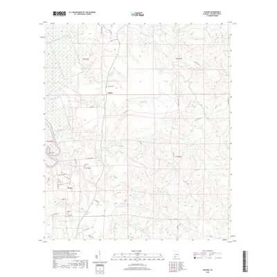
2018 Map of Vaughn
USGS Topo · Published 2018About this map
Latham and the neighboring settlement of Vaughn anchor this rural Baldwin County landscape, where the terrain is deeply etched by a network of creeks. Flowing through the northern reaches, Globe Creek, Beard Cr, and Philip Cr define the drainage patterns, while Halls Cr and Little Halls Cr wind through the central portion of the quadrangle. The topography is notable for its distinct rises like Red Hill, which overlooks Red Hill Cr and the low-lying wetlands of Coon Neck.
Find a feature on this map
53 named features on this map. Tap any name to fly to it.
Don’t see what you’re looking for? This feature index may not catch every label — zoom into the map to look around manually.
Map Details
Editions of this 2018 Vaughn Map
This is the sole edition of this map. No revisions or reprints were ever made.
Other maps of this area

1941 · Bay Minette
USGS Topo · 1:62,500

1942 · Perdido
USGS Topo · 1:62,500

1942 · Dyas
USGS Topo · 1:62,500

1943 · Bay Minette
USGS Topo · 1:62,500

1943 · Tensaw
USGS Topo · 1:62,500

1944 · Tensaw
USGS Topo · 1:62,500

1944 · Dyas
USGS Topo · 1:62,500

1944 · Perdido
USGS Topo · 1:62,500

1953 · Andalusia
USGS Topo · 1:250,000

1957 · Andalusia
USGS Topo · 1:250,000