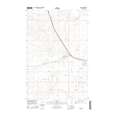
2014 Map of Vaughn
USGS Topo · Published 2014About this map
The confluence of Muddy Creek and the Sun River anchors this central Montana landscape, where the community of Vaughn serves as a local hub. The area's agricultural foundation is visible through features like the Sun River Valley Ditch and specialized infrastructure such as the H S D Feed Lot Rd. Local history is rooted in landmarks like the Vaughn Cem near the intersection of Central Ave and Us-89, reflecting the steady growth of this corridor.
Find a feature on this map
45 named features on this map. Tap any name to fly to it.
Don’t see what you’re looking for? This feature index may not catch every label — zoom into the map to look around manually.
Map Details
Editions of this 2014 Vaughn Map
This is the sole edition of this map. No revisions or reprints were ever made.
Other maps of this area

1886 · Great Falls
USGS Topo · 1:250,000

1949 · Cascade
USGS Topo · 1:62,500

1949 · Great Falls
USGS Topo · 1:62,500

1949 · Vaughn
USGS Topo · 1:62,500

1951 · Great Falls
USGS Topo · 1:62,500

1951 · Cascade
USGS Topo · 1:62,500

1952 · Vaughn
USGS Topo · 1:62,500

1954 · Great Falls
USGS Topo · 1:250,000

1955 · Gore Hill
USGS Topo · 1:62,500

1957 · Great Falls
USGS Topo · 1:250,000