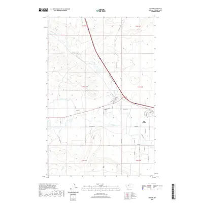
2020 Map of Vaughn
USGS Topo · Published 2020About this map
Vaughn sits at the confluence of the Sun River and Muddy Creek, serving as a central point in this part of Cascade County. The landscape is defined by the vital management of water, notably through the Sun River Valley Ditch, which supports the agricultural base of the surrounding plains. The settlement pattern shows a contrast between the concentrated community at Vaughn and the more dispersed residential development of Sun Prairie to the southeast. To the north and west, the terrain rises toward Taft Hill, while the valley floor is crisscrossed by a network of rural routes such as Neuman School Rd and Taft Hill Rd. Local history is anchored by the Vaughn Cem, located near the creek, providing a genealogical touchpoint for families in this river-valley region.
Find a feature on this map
45 named features on this map. Tap any name to fly to it.
Don’t see what you’re looking for? This feature index may not catch every label — zoom into the map to look around manually.
Map Details
Editions of this 2020 Vaughn Map
This is the sole edition of this map. No revisions or reprints were ever made.
Other maps of this area

1886 · Great Falls
USGS Topo · 1:250,000

1949 · Cascade
USGS Topo · 1:62,500

1949 · Great Falls
USGS Topo · 1:62,500

1949 · Vaughn
USGS Topo · 1:62,500

1951 · Great Falls
USGS Topo · 1:62,500

1951 · Cascade
USGS Topo · 1:62,500

1952 · Vaughn
USGS Topo · 1:62,500

1954 · Great Falls
USGS Topo · 1:250,000

1955 · Gore Hill
USGS Topo · 1:62,500

1957 · Great Falls
USGS Topo · 1:250,000