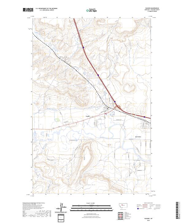
2024 Map of Vaughn
USGS Topo · Published 2024About this map
Sun River meanders through the heart of this landscape, anchoring a valley where water management and agriculture define the local layout. The community of Vaughn serves as a central hub, evidenced by the presence of a Po and the Vaughn Cem nearby. The influence of early irrigation and school systems is visible in the paths of the Sun River Valley Ditch and Neuman School Rd, which reflect the historical development of these plains. To the south, Sun Prairie emerges as a distinct residential area alongside the river, while the rising elevation of Taft Hill marks the transition away from the watercourse. This survey shows the modern connectivity of the Vaughn North Frontage Rd alongside established natural landmarks like Muddy Creek, illustrating how contemporary infrastructure overlays a foundation of rural settlement and resource management.
Find a feature on this map
44 named features on this map. Tap any name to fly to it.
Don’t see what you’re looking for? This feature index may not catch every label — zoom into the map to look around manually.
Map Details
Editions of this 2024 Vaughn Map
This is the sole edition of this map. No revisions or reprints were ever made.
Other maps of this area

1886 · Great Falls
USGS Topo · 1:250,000

1949 · Cascade
USGS Topo · 1:62,500

1949 · Great Falls
USGS Topo · 1:62,500

1949 · Vaughn
USGS Topo · 1:62,500

1951 · Great Falls
USGS Topo · 1:62,500

1951 · Cascade
USGS Topo · 1:62,500

1952 · Vaughn
USGS Topo · 1:62,500

1954 · Great Falls
USGS Topo · 1:250,000

1955 · Gore Hill
USGS Topo · 1:62,500

1957 · Great Falls
USGS Topo · 1:250,000