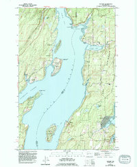
1953 Map of Vaughn
USGS Topo · Published 1994About this map
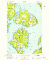
Case Inlet and Pickering Passage dominate this landscape, defining the complex coastline of the Key Peninsula and the surrounding islands in the early 1990s. The settlement pattern reflects a long history of maritime orientation, with established communities like Vaughn, Home, and Lakebay situated along sheltered coves and bays. This 1992 field-checked data shows the social infrastructure of the peninsula, including the Key Peninsula Civic Center and the Lakebay Community Center, alongside essential services like the Key Peninsula School.
Find a feature on this map
45 named features on this map. Tap any name to fly to it.
Don’t see what you’re looking for? This feature index may not catch every label — zoom into the map to look around manually.
Map Details
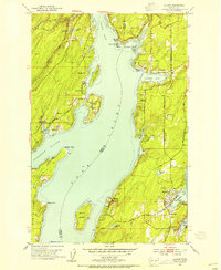
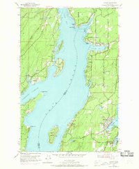
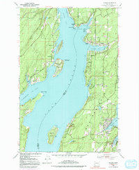
Editions of this 1953 Vaughn Map
4 editions found
Other maps of this area

1937 · Olympia
USGS Topo · 1:62,500

1938 · Allyn
USGS Topo · 1:62,500

1940 · Anderson Island
USGS Topo · 1:62,500

1942 · Gig Harbor
USGS Topo · 1:62,500

1943 · Gig Harbor
USGS Topo · 1:62,500

1948 · Anderson Island
USGS Topo · 1:62,500
1948 · Anderson Island
USGS Topo · 1:24,000

1949 · Olympia
USGS Topo · 1:62,500
1953 · Burley
USGS Topo · 1:24,000
1953 · Sylvan
USGS Topo · 1:24,000