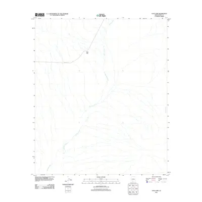
2011 Map of Vaya Chin
USGS Topo · Published 2011About this map
Vaya Chin occupies a central position within this 2011 survey, situated along the path of Indian Rte-34. The settlement is defined by its relationship to the desert hydrology of Pima County, specifically the prominent San Simon Wash which traverses the landscape from the northwest down toward the south. The drainage patterns are a primary feature of this arid region, with the eastern portion of the sheet marked by the presence of Gu Achi Wash. This map captures the area in the early 21st century, illustrating a remote landscape where transportation is focused on a single primary route connecting the small settlement to the broader region. The topographic detail provided by the U.S. Geological Survey highlights the subtle elevation changes that direct the seasonal flow of these significant desert washes.
Find a feature on this map
4 named features on this map. Tap any name to fly to it.
Don’t see what you’re looking for? This feature index may not catch every label — zoom into the map to look around manually.
Map Details
Editions of this 2011 Vaya Chin Map
This is the sole edition of this map. No revisions or reprints were ever made.
Other maps of this area

1953 · Ajo
USGS Topo · 1:250,000

1957 · Ajo
USGS Topo · 1:250,000

1958 · Ajo
USGS Topo · 1:250,000

1962 · Ajo
USGS Topo · 1:250,000

1963 · Ajo
USGS Topo · 1:250,000

1963 · Gu Achi
USGS Topo · 1:62,500

1963 · Quijotoa Mts
USGS Topo · 1:62,500

1963 · Cimarron Peak
USGS Topo · 1:62,500

1963 · Pisinimo
USGS Topo · 1:62,500

1967 · Ajo
USGS Topo · 1:250,000