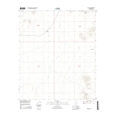
2014 Map of Vaya Chin
USGS Topo · Published 2014About this map
Vaya Chin sits at the junction of Bureau of Indian Affairs routes Bia-34 and Bia-64, serving as a focal point in this portion of Pima County. The landscape is defined by the drainage patterns of San Simon Wash, which meanders through the central terrain towards the south. The topography is anchored by significant elevations, including the Castle Mountains in the north and the prominent peaks of Sierra Blanca in the southeastern corner. These natural landmarks overlook the broad expanse of Window Valley. This survey captures the rural infrastructure of the region, illustrating the relationship between the primary settlement and the surrounding arid geography, where road networks are closely tied to the natural contours and watercourses of the desert floor.
Find a feature on this map
11 named features on this map. Tap any name to fly to it.
Don’t see what you’re looking for? This feature index may not catch every label — zoom into the map to look around manually.
Map Details
Editions of this 2014 Vaya Chin Map
This is the sole edition of this map. No revisions or reprints were ever made.
Other maps of this area

1953 · Ajo
USGS Topo · 1:250,000

1957 · Ajo
USGS Topo · 1:250,000

1958 · Ajo
USGS Topo · 1:250,000

1962 · Ajo
USGS Topo · 1:250,000

1963 · Ajo
USGS Topo · 1:250,000

1963 · Gu Achi
USGS Topo · 1:62,500

1963 · Quijotoa Mts
USGS Topo · 1:62,500

1963 · Cimarron Peak
USGS Topo · 1:62,500

1963 · Pisinimo
USGS Topo · 1:62,500

1967 · Ajo
USGS Topo · 1:250,000