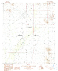
1990 Map of Vaya Chin
USGS Topo · Published 1991About this map
Vaya Chin sits at the heart of this desert landscape within the Papago Indian Reservation, where the seasonal drainage of San Simon Wash defines the movement of water across the basin. The map reveals the practical infrastructure of life in the arid Sonoran region, marked by numerous Check Dams, a Water Tank, and a Well near the settlement. The Gila and Salt River Meridian bisects the quadrangle, serving as a critical surveying reference point for the surrounding Valley. To the east and northeast, the terrain rises sharply into the Sierra Blanca and the Castle Mountains, while isolated peaks like Stanley stand apart from the primary ranges. Local land use is further evidenced by a Cem and several Corral sites, illustrating a landscape managed for both community and cattle.
Find a feature on this map
19 named features on this map. Tap any name to fly to it.
Don’t see what you’re looking for? This feature index may not catch every label — zoom into the map to look around manually.
Map Details
Editions of this 1990 Vaya Chin Map
This is the sole edition of this map. No revisions or reprints were ever made.
Other maps of this area

1953 · Ajo
USGS Topo · 1:250,000

1957 · Ajo
USGS Topo · 1:250,000

1958 · Ajo
USGS Topo · 1:250,000

1962 · Ajo
USGS Topo · 1:250,000

1963 · Ajo
USGS Topo · 1:250,000

1963 · Gu Achi
USGS Topo · 1:62,500

1963 · Quijotoa Mts
USGS Topo · 1:62,500

1963 · Cimarron Peak
USGS Topo · 1:62,500

1963 · Pisinimo
USGS Topo · 1:62,500

1967 · Ajo
USGS Topo · 1:250,000