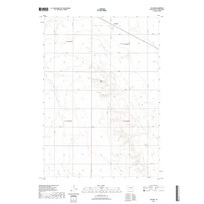
2017 Map of Vayland
USGS Topo · Published 2017About this map
Vayland serves as a central focal point in this portion of Hand County, located along the northern edge of the survey near the intersection of several county roads. The landscape is defined by the subtle drainage patterns of Cain Cr, Silver Cr, and E Pearl Cr, which wind through the township boundaries of t112n r67w and t111n r66w. A distinctive local landmark, Majors Gulch, cuts through the central terrain, providing a natural break in the predominantly rectilinear grid of the Public Land Survey System.
Find a feature on this map
24 named features on this map. Tap any name to fly to it.
Don’t see what you’re looking for? This feature index may not catch every label — zoom into the map to look around manually.
Map Details
Editions of this 2017 Vayland Map
This is the sole edition of this map. No revisions or reprints were ever made.
Other maps of this area

1899 · Redfield
USGS Topo · 1:125,000

1949 · Vayland SE
USGS Topo · 1:24,000

1949 · Vayland SW
USGS Topo · 1:24,000

1950 · Vayland
USGS Topo · 1:24,000

1950 · Wessington
USGS Topo · 1:24,000

1950 · Vayland NW
USGS Topo · 1:24,000

1951 · Vayland SW
USGS Topo · 1:24,000

1951 · Wessington SW
USGS Topo · 1:24,000

1951 · Vayland SE
USGS Topo · 1:24,000

1953 · Huron
USGS Topo · 1:250,000