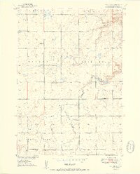
1951 Map of Vayland SE
USGS Topo · Published 1951About this map
Rose Hill Lake and the winding course of Sand Creek define the central drainage of this Hand County landscape during the early 1950s. The map reveals a post-war rural infrastructure characterized by a dense network of one-room schoolhouses, including Rowen Sch, Palmer Sch, Todd Sch, and Prairie View Sch, which served the surrounding agricultural townships of Highland and Rose Hill. These institutions, alongside the Rose Hill Ch and a small Cem, represent the social anchors of a prairie community organized around the section lines of the Missouri River Basin development era.
Find a feature on this map
19 named features on this map. Tap any name to fly to it.
Don’t see what you’re looking for? This feature index may not catch every label — zoom into the map to look around manually.
Map Details
Editions of this 1951 Vayland SE Map
2 editions found
Other maps of this area

1949 · Vayland SE
USGS Topo · 1:24,000

1949 · Vayland SW
USGS Topo · 1:24,000

1950 · Vayland
USGS Topo · 1:24,000

1950 · Wessington
USGS Topo · 1:24,000

1950 · Vayland NW
USGS Topo · 1:24,000

1951 · Vayland SW
USGS Topo · 1:24,000

1951 · Wessington SW
USGS Topo · 1:24,000

1951 · Vayland SE
USGS Topo · 1:24,000

1953 · Huron
USGS Topo · 1:250,000

1954 · Huron
USGS Topo · 1:250,000