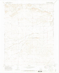
1971 Map of Vega Corral
USGS Topo · Published 1974About this map
The Apishapa River cuts a prominent path through this Las Animas County landscape, where the high plains meet the distinct geological formation of The Little Hogback. In this 1971 record, the human footprint is defined by water management and ancestral markers, notably the Widowfield Ditch and the Valdez Cem located south of the river. The small settlement of Vega Corral sits near the northern banks of the Apishapa, surrounded by a network of drainage features like Salado Creek and Agua Del Arroyo. The presence of several Prospects and a Gravel Pit suggests localized resource extraction in a region largely dominated by open range and seasonal waterways.
Find a feature on this map
13 named features on this map. Tap any name to fly to it.
Don’t see what you’re looking for? This feature index may not catch every label — zoom into the map to look around manually.
Map Details
Editions of this 1971 Vega Corral Map
This is the sole edition of this map. No revisions or reprints were ever made.
Other maps of this area

1891 · Walsenburg
USGS Topo · 1:125,000

1891 · Spanish Peaks
USGS Topo · 1:125,000

1891 · Apishapa
USGS Topo · 1:125,000

1892 · Elmoro
USGS Topo · 1:125,000

1893 · Spanish Peaks
USGS Topo · 1:125,000

1893 · Apishapa
USGS Topo · 1:125,000

1893 · Elmoro
USGS Topo · 1:125,000

1894 · Walsenburg
USGS Topo · 1:125,000

1895 · Spanish Peaks
USGS Topo · 1:125,000

1897 · Walsenburg
USGS Topo · 1:125,000