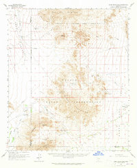
1963 Map of Vekol Mountains
USGS Topo · Published 1965About this map
Mining operations and Papago settlements define this arid stretch of the Papago Indian Reservation as it was surveyed in the 1930s and updated in the early 1960s. The landscape is marked by historical extraction sites including the Vekol Mine (Ruins), Reward Mine, and Great Eastern Mine, which are situated at the base of the Vekol Mountains. These operations, along with the Copperosity Mine and Greenback Mine, point to an era of concentrated prospecting within the Copperosity Hills.
Find a feature on this map
37 named features on this map. Tap any name to fly to it.
Don’t see what you’re looking for? This feature index may not catch every label — zoom into the map to look around manually.
Map Details
Editions of this 1963 Vekol Mountains Map
2 editions found
Other maps of this area

1922 · Casa Grande
USGS Topo · 1:62,500

1924 · Casa Grande
USGS Topo · 1:62,500

1934 · Silver Bell
USGS Topo · 1:125,000

1941 · Vekol Mountains
USGS Topo · 1:62,500

1942 · Silver Reef Mountains
USGS Topo · 1:62,500

1942 · Vekol Mountains
USGS Topo · 1:62,500

1946 · Antelope Peak
USGS Topo · 1:62,500

1948 · Antelope Peak
USGS Topo · 1:62,500

1951 · Estrella
USGS Topo · 1:62,500

1953 · Ajo
USGS Topo · 1:250,000
Featured Places
- Chiapuk, Sif Oidak District
- Hickiwan, AZ
- Sif Oidak District, AZ
- Kohatk, Sif Oidak District
- Maricopa County, AZ