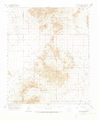
1963 Map of Vekol Mountains
USGS Topo · Published 1973About this map
Sif Vaya and Chiapuk sit within the vast southern Arizona landscape during this mid-century survey, which documents the topography of the Papago Indian Reservation. The settlement patterns shown here are defined by deep desert basins and the prominent mountain ranges that divide them. Based on fieldwork originally conducted in the late 1930s and updated in the 1960s, this record provides a look at the desert floor before significant modern development, emphasizing the isolated nature of these communities. These locations illustrate how indigenous habitation and movement across the terrain were tied to the available natural resources and seasonal water sources in a demanding arid environment.
Find a feature on this map
2 named features on this map. Tap any name to fly to it.
Don’t see what you’re looking for? This feature index may not catch every label — zoom into the map to look around manually.
Map Details
Editions of this 1963 Vekol Mountains Map
2 editions found
Other maps of this area

1922 · Casa Grande
USGS Topo · 1:62,500

1924 · Casa Grande
USGS Topo · 1:62,500

1934 · Silver Bell
USGS Topo · 1:125,000

1941 · Vekol Mountains
USGS Topo · 1:62,500

1942 · Silver Reef Mountains
USGS Topo · 1:62,500

1942 · Vekol Mountains
USGS Topo · 1:62,500

1946 · Antelope Peak
USGS Topo · 1:62,500

1948 · Antelope Peak
USGS Topo · 1:62,500

1951 · Estrella
USGS Topo · 1:62,500

1953 · Ajo
USGS Topo · 1:250,000
Featured Places
- Chiapuk, Sif Oidak District
- Hickiwan, AZ
- Sif Oidak District, AZ
- Kohatk, Sif Oidak District
- Maricopa County, AZ