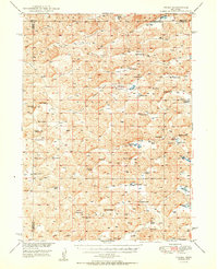
1950 Map of Velma
USGS Topo · Published 1950About this map
Sandhills ranching culture dominates this mid-century landscape on the border of Garden and Arthur Counties. The map reveals an intricate network of named depressions and drainages, such as Voss Valley and Doherty Valley, which dictated the placement of homesteads and essential one-room schoolhouses like School No 27 and School No 40. The small settlement of Velma serves as a central point in an area otherwise defined by sprawling family operations, including the Schneede Ranch, Hall Ranch, and Porter Ranch. These holdings are often centered around vital water sources in an arid environment, exemplified by Jensen Lake and Frye Lake. The mapping, completed as part of the Department of the Interior program for the development of the Missouri River Basin, documents the precise location of windmills and early mid-century roads that connected these remote ranching outposts before later consolidation changed the rural character of the Nebraska Panhandle.
Find a feature on this map
62 named features on this map. Tap any name to fly to it.
Don’t see what you’re looking for? This feature index may not catch every label — zoom into the map to look around manually.
Map Details
Editions of this 1950 Velma Map
2 editions found
Other maps of this area

1897 · Ogallala
USGS Topo · 1:125,000

1900 · Chappell
USGS Topo · 1:125,000

1900 · Ogallala
USGS Topo · 1:125,000

1948 · George Lake
USGS Topo · 1:62,500

1948 · Spring Valley
USGS Topo · 1:62,500

1949 · Arthur
USGS Topo · 1:62,500

1949 · Rackett
USGS Topo · 1:62,500

1950 · Spring Valley
USGS Topo · 1:62,500

1950 · Velma
USGS Topo · 1:62,500

1950 · George Lake
USGS Topo · 1:62,500