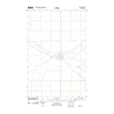
2011 Map of Velva
USGS Topo · Published 2011About this map
Velva sits at the heart of this North Dakota landscape, situated along the winding curves of the Souris River. The topography of McHenry County is defined by its drainages, where the river's meandering path is joined by several watercourses including Oak Creek, Spring Creek, and the depression of Bonnes Coulee. These features illustrate the natural hydrology of the plains before it transitions into more developed agricultural grids. Outside the primary settlement, the map reveals a systematic network of section roads like 49th St N and 18th Ave N, alongside smaller landmarks such as Potters Lake. This survey provides a clear view of the infrastructure and natural waterways that supported this prairie community in the early 21st century, showing how modern transit corridors such as Prospect Trl and Valley Rd intersect with the traditional township lines.
Find a feature on this map
28 named features on this map. Tap any name to fly to it.
Don’t see what you’re looking for? This feature index may not catch every label — zoom into the map to look around manually.
Map Details
Editions of this 2011 Velva Map
This is the sole edition of this map. No revisions or reprints were ever made.
Other maps of this area

1929 · Sawyer
USGS Topo · 1:62,500

1929 · Benedict
USGS Topo · 1:62,500

1929 · Kongsberg
USGS Topo · 1:62,500

1948 · Voltaire
USGS Topo · 1:24,000

1948 · Velva
USGS Topo · 1:62,500

1948 · Sawyer
USGS Topo · 1:24,000

1949 · Norwich
USGS Topo · 1:24,000

1949 · Sawyer
USGS Topo · 1:24,000

1949 · Simcoe
USGS Topo · 1:24,000

1949 · Sawyer NE
USGS Topo · 1:24,000