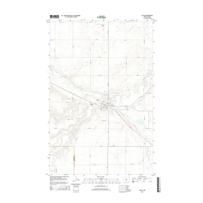
2014 Map of Velva
USGS Topo · Published 2014About this map
Velva sits at a strategic bend in the Souris River, where the river valley carves through the North Dakota plains. The community is anchored by a grid that includes Central Ave E and Main St N, while the surrounding landscape is defined by drainage features like Bonnes Coulee and Oak Cr. To the north, the small Linrud Airstrip provides a rural aviation link, while to the southeast, the terrain shifts near Potters Lake and the winding course of Spring Cr. The map captures the boundary line between Ward Co and McHenry Co, illustrating how the town's footprint interacts with these administrative and geographic borders. Transport across the region is dominated by Us-52, which cuts diagonally across the township, connecting the river valley to the higher ground of the plains.
Find a feature on this map
38 named features on this map. Tap any name to fly to it.
Don’t see what you’re looking for? This feature index may not catch every label — zoom into the map to look around manually.
Map Details
Editions of this 2014 Velva Map
This is the sole edition of this map. No revisions or reprints were ever made.
Other maps of this area

1929 · Sawyer
USGS Topo · 1:62,500

1929 · Benedict
USGS Topo · 1:62,500

1929 · Kongsberg
USGS Topo · 1:62,500

1948 · Voltaire
USGS Topo · 1:24,000

1948 · Velva
USGS Topo · 1:62,500

1948 · Sawyer
USGS Topo · 1:24,000

1949 · Norwich
USGS Topo · 1:24,000

1949 · Sawyer
USGS Topo · 1:24,000

1949 · Simcoe
USGS Topo · 1:24,000

1949 · Sawyer NE
USGS Topo · 1:24,000