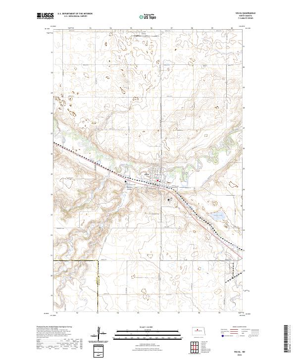
2024 Map of Velva
USGS Topo · Published 2024About this map
Velva sits at the heart of this landscape where the Souris River meanders through McHenry County, shaping the surrounding terrain. The town's layout is defined by a traditional grid including N Main St and Central Ave, bounded to the south by the sloping drainage of Bonnes Coulee. Local history is anchored at the Holy Cross Catholic Cem and Velva Cem, which serve as vital points for genealogical research in this rural North Dakota community. The terrain beyond the town site is marked by water features like Potters Lake and the winding paths of Spring Creek and Oak Creek. The presence of the Linrud Airstrip to the north and the nearby Ward Co McHenry Co line highlights the area's role as a regional hub for the surrounding agricultural prairie.
Find a feature on this map
54 named features on this map. Tap any name to fly to it.
Don’t see what you’re looking for? This feature index may not catch every label — zoom into the map to look around manually.
Map Details
Editions of this 2024 Velva Map
This is the sole edition of this map. No revisions or reprints were ever made.
Other maps of this area

1929 · Sawyer
USGS Topo · 1:62,500

1929 · Benedict
USGS Topo · 1:62,500

1929 · Kongsberg
USGS Topo · 1:62,500

1948 · Voltaire
USGS Topo · 1:24,000

1948 · Velva
USGS Topo · 1:62,500

1948 · Sawyer
USGS Topo · 1:24,000

1949 · Norwich
USGS Topo · 1:24,000

1949 · Sawyer
USGS Topo · 1:24,000

1949 · Simcoe
USGS Topo · 1:24,000

1949 · Sawyer NE
USGS Topo · 1:24,000