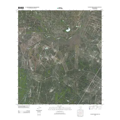
2013 Map of Venado Creek East
USGS Topo · Published 2013About this map
Frank Nunley Lake and Martinena Ranch Lake serve as key water sources in this arid stretch of Webb County, where the landscape is defined by an intricate network of seasonal drainage. The hydrology of the region is dominated by several significant creeks, including Dolores Cr, Los Olmos Cr, and Venado Cr, which carve paths through the brush country. These waterways, alongside Carrizitos Cr, suggest a land primarily utilized for large-scale ranching operations, with the man-made lakes indicating the vital infrastructure necessary to sustain livestock in South Texas. The absence of concentrated settlements on this sheet highlights the rural and expansive nature of the local economy during this era.
Find a feature on this map
6 named features on this map. Tap any name to fly to it.
Don’t see what you’re looking for? This feature index may not catch every label — zoom into the map to look around manually.
Map Details
Editions of this 2013 Venado Creek East Map
This is the sole edition of this map. No revisions or reprints were ever made.
Other maps of this area

1929 · Cotulla
USGS Topo · 1:125,000

1953 · Crystal City
USGS Topo · 1:250,000

1955 · Crystal City
USGS Topo · 1:250,000

1956 · Becerra
USGS Topo · 1:62,500

1956 · Webb
USGS Topo · 1:62,500

1956 · Laredo
USGS Topo · 1:250,000

1957 · Encinal
USGS Topo · 1:62,500

1957 · Caiman Creek
USGS Topo · 1:62,500

1961 · Crystal City
USGS Topo · 1:250,000

1968 · Crystal City
USGS Topo · 1:250,000