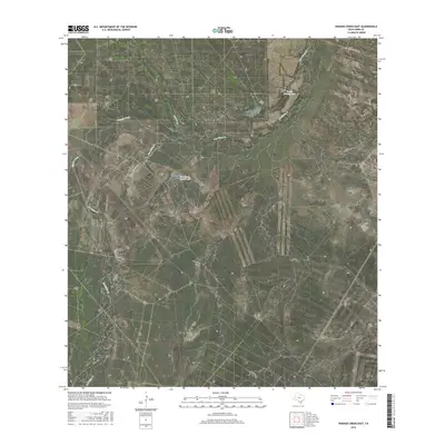
2016 Map of Venado Creek East
USGS Topo · Published 2016About this map
The seasonal waterways of the South Texas brush country define this portion of Webb County, where ephemeral streams like Venado Creek and Carrizitos Cr carve through a landscape of gentle draws and breaks. Water management is central to the land's utility in this semi-arid region, evidenced by the presence of Martinena Ranch Lake and Frank Nunley Lake, which likely serve as vital stock tanks for local ranching operations. The dendritic drainage pattern of Los Olmos Cr and its tributaries, such as Dolores Cr, illustrates the natural flow of runoff toward larger basins. Apart from the established corridor of Ranch Rd 863 in the northeast corner, the area remains dominated by large private holdings and rugged ranchland, typical of the Rio Grande Plain's interior.
Find a feature on this map
7 named features on this map. Tap any name to fly to it.
Don’t see what you’re looking for? This feature index may not catch every label — zoom into the map to look around manually.
Map Details
Editions of this 2016 Venado Creek East Map
This is the sole edition of this map. No revisions or reprints were ever made.
Other maps of this area

1929 · Cotulla
USGS Topo · 1:125,000

1953 · Crystal City
USGS Topo · 1:250,000

1955 · Crystal City
USGS Topo · 1:250,000

1956 · Becerra
USGS Topo · 1:62,500

1956 · Webb
USGS Topo · 1:62,500

1956 · Laredo
USGS Topo · 1:250,000

1957 · Encinal
USGS Topo · 1:62,500

1957 · Caiman Creek
USGS Topo · 1:62,500

1961 · Crystal City
USGS Topo · 1:250,000

1968 · Crystal City
USGS Topo · 1:250,000