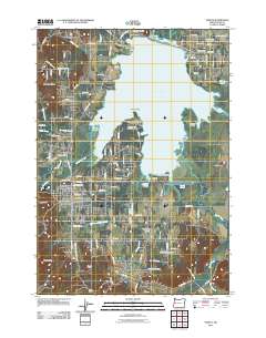
2011 Map of Veneta
USGS Topo · Published 2011About this map
Fern Ridge Lake dominates this Western Oregon landscape, created by the Fern Ridge Dam and fed by the Long Tom River and Inman Creek. The reservoir's irregular shoreline includes significant landforms like Richardson Point, Perkins Peninsula, and Gibson Island, illustrating the complex intersection of water management and local geography. The settlements of Veneta and Elmira serve as the primary population centers, each maintaining its own postal station such as the Veneta Post Office.
Find a feature on this map
117 named features on this map. Tap any name to fly to it.
Don’t see what you’re looking for? This feature index may not catch every label — zoom into the map to look around manually.
Map Details
Editions of this 2011 Veneta Map
This is the sole edition of this map. No revisions or reprints were ever made.
Other maps of this area

1909 · Elmira
USGS Topo · 1:62,500

1910 · Eugene
USGS Topo · 1:62,500

1921 · Cottage Grove
USGS Topo · 1:62,500

1922 · Elmira
USGS Topo · 1:62,500

1940 · Eugene
USGS Topo · 1:62,500

1942 · Elmira
USGS Topo · 1:62,500

1942 · Crow
USGS Topo · 1:62,500

1945 · Crow
USGS Topo · 1:62,500

1946 · Eugene
USGS Topo · 1:62,500

1949 · Eugene
USGS Topo · 1:62,500