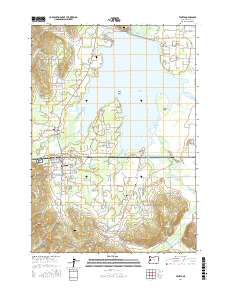
2017 Map of Veneta
USGS Topo · Published 2017About this map
Fern Ridge Lake dominates the eastern half of this landscape, its waters surrounding landmarks like Signal Island and Gibson Island and shaping the irregular shoreline of Perkins Peninsula. To the west, the settlements of Veneta and Elmira serve as local hubs along the valley floor, where the Long Tom River flows toward the reservoir. The map reveals a dense network of country roads—such as England Loop and Jeans Rd—that service the rural properties between the wetlands and the surrounding hills. Genealogists can identify historical family-named sites including Richardson Cem, Inman Cem, and Central Cem, as well as the more secluded Mounse Burial site. The terrain rises to the south and west toward Crow Hill and Rocky Butte, marking the transition from the active reservoir basin to the elevated ridges overlooking the W Fork Coyote Cr.
Find a feature on this map
118 named features on this map. Tap any name to fly to it.
Don’t see what you’re looking for? This feature index may not catch every label — zoom into the map to look around manually.
Map Details
Editions of this 2017 Veneta Map
This is the sole edition of this map. No revisions or reprints were ever made.
Other maps of this area

1909 · Elmira
USGS Topo · 1:62,500

1910 · Eugene
USGS Topo · 1:62,500

1921 · Cottage Grove
USGS Topo · 1:62,500

1922 · Elmira
USGS Topo · 1:62,500

1940 · Eugene
USGS Topo · 1:62,500

1942 · Elmira
USGS Topo · 1:62,500

1942 · Crow
USGS Topo · 1:62,500

1945 · Crow
USGS Topo · 1:62,500

1946 · Eugene
USGS Topo · 1:62,500

1949 · Eugene
USGS Topo · 1:62,500