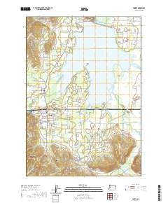
2020 Map of Veneta
USGS Topo · Published 2020About this map
Fern Ridge Lake dominates the central landscape of this western Willamette Valley quadrangle, where the Long Tom River feeds a complex network of wetlands and sloughs. The settlement of Veneta serves as the primary hub south of the water, while Elmira sits just to the west of the lake's fingers. The terrain is a mix of low-lying floodplains and prominent rises like Fisher Butte and Rocky Butte, which overlook the surrounding drainages of Coyote Cr and its various forks. For genealogists and local historians, several burial sites are documented across the landscape, including Richardson Cem near the northern shore and the more secluded Mounse Burial further south. The map details a transition from organized town streets to the rural agricultural and forested lands that define the margins of the Fern Ridge area.
Find a feature on this map
116 named features on this map. Tap any name to fly to it.
Don’t see what you’re looking for? This feature index may not catch every label — zoom into the map to look around manually.
Map Details
Editions of this 2020 Veneta Map
This is the sole edition of this map. No revisions or reprints were ever made.
Other maps of this area

1909 · Elmira
USGS Topo · 1:62,500

1910 · Eugene
USGS Topo · 1:62,500

1921 · Cottage Grove
USGS Topo · 1:62,500

1922 · Elmira
USGS Topo · 1:62,500

1940 · Eugene
USGS Topo · 1:62,500

1942 · Elmira
USGS Topo · 1:62,500

1942 · Crow
USGS Topo · 1:62,500

1945 · Crow
USGS Topo · 1:62,500

1946 · Eugene
USGS Topo · 1:62,500

1949 · Eugene
USGS Topo · 1:62,500