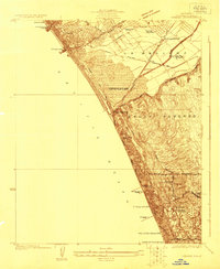
1923 Map of Venice
USGS Topo · Published 1923About this map
Coastal development and industrial infrastructure define the Los Angeles shoreline in the early 1920s. The map captures the distinct characters of Ocean Park and Venice with their respective piers, while further south, the Standard Oil Refinery and its associated Standard Oil Pier signal the region's burgeoning energy sector. Between these hubs, the landscape includes the Recreation Gun Club and a lone Oil Derrick standing near Alla.
Find a feature on this map
37 named features on this map. Tap any name to fly to it.
Don’t see what you’re looking for? This feature index may not catch every label — zoom into the map to look around manually.
Map Details
Editions of this 1923 Venice Map
This is the sole edition of this map. No revisions or reprints were ever made.
Other maps of this area

1894 · Los Angeles
USGS Topo · 1:62,500

1896 · Redondo
USGS Topo · 1:62,500

1896 · Santa Monica
USGS Topo · 1:62,500

1898 · Santa Monica
USGS Topo · 1:62,500

1900 · Los Angeles
USGS Topo · 1:62,500

1901 · Southern California Sheet No. 1
USGS Topo · 1:250,000

1902 · Santa Monica
USGS Topo · 1:62,500

1903 · Calabasas
USGS Topo · 1:62,500

1903 · Camulos
USGS Topo · 1:125,000

1904 · Southern California Sheet No. 1
USGS Topo · 1:250,000